


Fire left lead in Eaton soils, and scientists disagree on how much remains
EPA combined soil from 30 spots on each property into one sample and called most lots safe, but a Purdue engineer says that method hides dangerous hot spots. One tested lot reached 705 mg/kg.
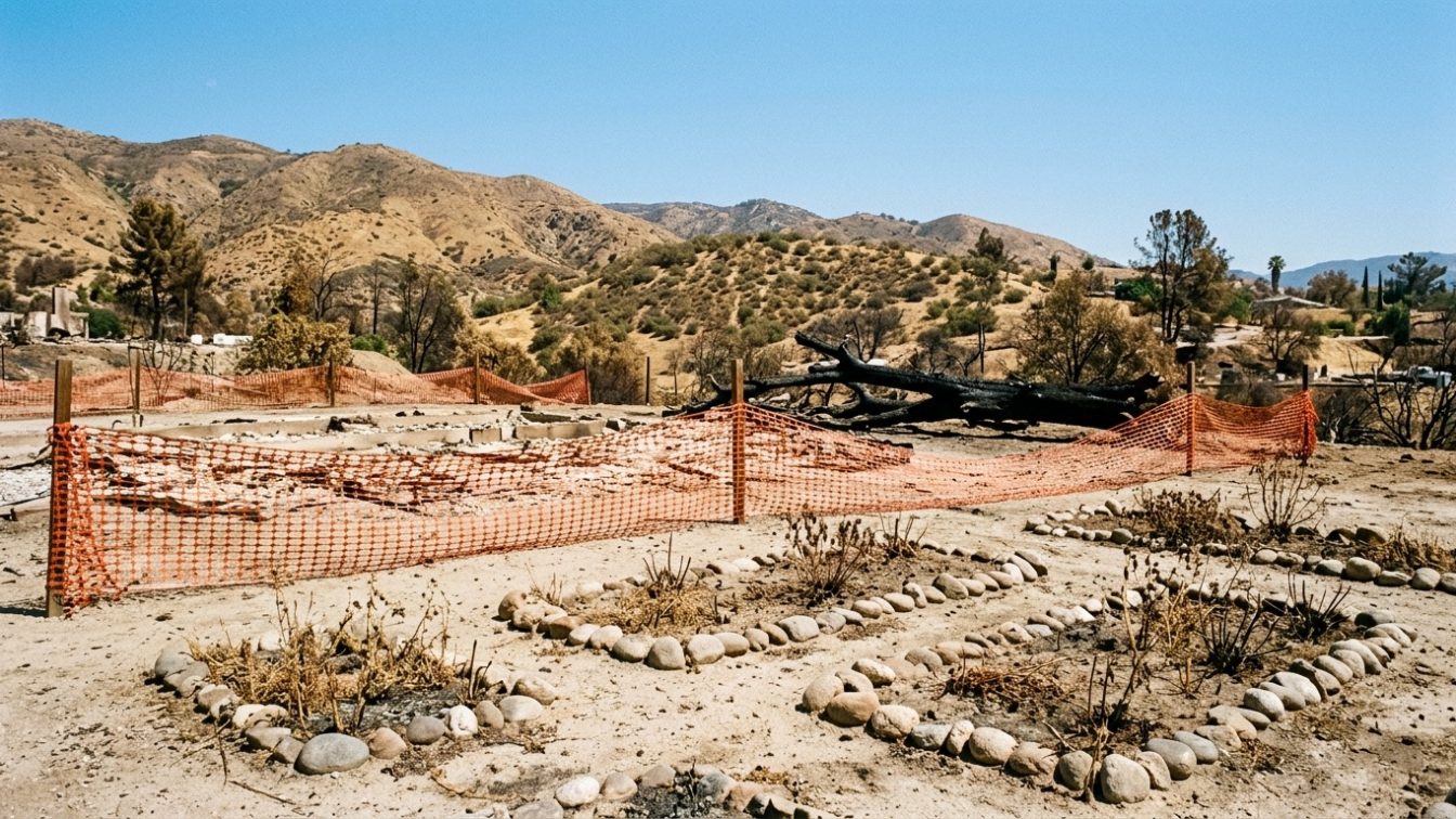
Table of contents
Summary of this article
- The Eaton Fire destroyed 9,400 homes and structures in the Altadena area in January 2025 and sent smoke containing lead, arsenic, and asbestos into the air, NBC News reported on May 20, 2026.
- The EPA tested about 100 homes selected at random, roughly 1% of the burned zone, and said residents should feel assured most properties are safe.
- The median surface lead concentration was 31 mg/kg, below California's 80 mg/kg and the EPA's 200 mg/kg screening levels; below the surface the median was 43 mg/kg.
- Five of the 100 lots exceeded federal screening standards and 17 exceeded California's stricter standards; one property reached 705 mg/kg, approaching the 1,000 mg/kg hazardous-waste threshold.
- The EPA pooled soil from 30 locations per property into composite samples; Purdue professor Andrew Whelton says that method produces averages that obscure hot spots.
- Whelton says the results are "not representative" of the Eaton Fire area and that testing covered only the ash footprint the Army Corps scraped, not the rest of each property.
- The Army Corps scraped up to 6 inches of soil during debris removal but did not perform soil testing; two whistleblowers said the cleanup was inconsistent and rushed.
- Lead is a neurotoxin most dangerous to young children; it reaches them through hand-to-mouth contact, tracked-in soil, and contaminated dust.
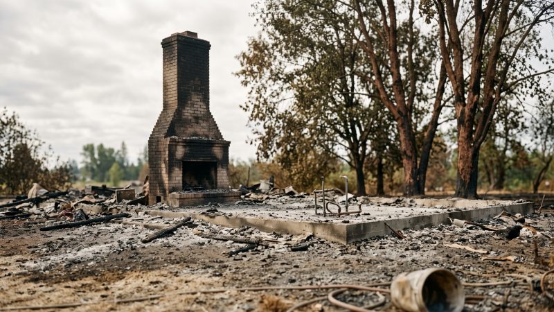
The Eaton Fire destroyed 9,400 homes and structures in the Altadena area in January 2025 and sent smoke containing lead, arsenic, and asbestos into the air, where it settled onto the surrounding ground. NBC News, in reporting by Evan Bush published May 20, 2026, documented the contamination and a scientific dispute over how much of it remains.
The dispute comes down to a testing method. The U.S. Environmental Protection Agency (EPA) tested about 100 homes and concluded most properties are safe. Andrew Whelton, a professor of civil, environmental, and ecological engineering at Purdue University, says the method the agency used hides the very contamination residents most need to find.
For any family returning to a burned neighborhood, and for anyone living on land where fire, industry, or old paint may have left lead behind, the disagreement matters. Lead is a neurotoxin. How you test for it decides whether you find it.
What the Fire Put in the Ground
A house fire is a chemistry event. Older homes, built before lead was phased out of paint and pipes, hold lead in their building materials. When they burn, that lead does not disappear. It rides the smoke as fine particles and settles onto soil, roofs, and surfaces downwind.
Altadena was built for this outcome. The area has older houses built before lead was phased out of building supplies, NBC News reported. The Eaton Fire burned 9,400 of them, releasing a plume that carried lead, arsenic, and asbestos across the community and left contamination in the soil where it landed.
Lead in that soil is a lasting problem. It does not break down. It stays where it settles until someone removes it or covers it, which is why a January 2025 fire is a 2026 soil question.
What the EPA Found
The EPA tested 100 homes selected at random from the debris cleanup zone, about 1% of the burned properties. The headline result was reassuring.
The median surface lead concentration was 31 milligrams per kilogram (mg/kg) of soil, well below the levels California (80 mg/kg) and the EPA (200 mg/kg) consider worthy of concern. Below the surface, the median was 43 mg/kg. Overall, most tested properties fell under both state and federal thresholds.
“That should really give residents confidence that the work that the Army Corps did addressed the fire-related contaminants, particularly lead,” said Michael Montgomery, director of the EPA Region 9 Superfund and Emergency Management Division, which conducted the testing. Montgomery said the agency can say with 95% confidence that the addressed burn areas in Altadena and Pasadena were below both screening levels.
The full results were more mixed than the median suggests. Five of the 100 lots exceeded federal screening standards. Seventeen exceeded California’s stricter 80 mg/kg standard. And one property reached 705 mg/kg, more than eight times the California threshold and approaching the 1,000 mg/kg level at which soil is considered hazardous waste requiring disposal in a special landfill.
The Method Behind the Dispute
The disagreement is not about the numbers the EPA reported. It is about how those numbers were produced.
At each property, the EPA collected soil at two depths from 30 locations within the “ash footprint”, the area the Army Corps chose to scrape. The agency then pooled the soil from those 30 locations into two composite samples per property: one at the surface, one about 6 inches down. Each property, in other words, was reduced to two averaged numbers.
Averaging is the problem, Whelton says. Pooling soil from 30 locations produces a single figure that blends clean spots with contaminated ones, obscuring hot spots, concentrated patches of high lead at specific points on a property.
“We know, based on prior experiences in California, that hot spots are real after debris removal, where contractors fail to remove ash and debris,” Whelton said. “Even individuals that pass this individual testing may have lead levels that exceed lead levels on parts of their property, but this testing wasn’t designed to figure that out.”
A composite sample cannot flag a dangerous corner of a yard if the rest of the yard is clean. The average washes it out. For a family with a toddler who plays in one particular patch of dirt, the average is the wrong number.
Two Gaps in the Testing
Whelton identified two limits that narrow what the EPA results can claim.
First, representativeness. “The results they have are not representative of the Eaton Fire area,” Whelton said. “They were collected in a way that cannot be compared to existing data other organizations are collecting or to what Californians or California businesses have come to expect for property safety.” Consultants for the Los Angeles County Department of Public Health and private groups have tested soil in the area with scattered results, many prompting concern.
Second, coverage. The EPA tested only within the ash footprint, the zone the Army Corps chose to scrape. The results say nothing about the rest of a property. The Army Corps removed debris from about two-thirds of lots where homes burned down but did not perform soil testing, leaving residents unsure about the parts of their land the cleanup never touched.
The cleanup itself has drawn scrutiny. The debris removal, in which the Army Corps scraped up to 6 inches of soil, has been questioned since it began in 2025. Two whistleblowers told NBC News the cleanup was inconsistent and rushed; one said workers left behind more debris than during previous wildfires. “It’s so incomplete,” one said.
The 705 mg/kg Property
One data point carries more weight than the median. The property that averaged 705 mg/kg is worrisome precisely because it is an average, Whelton said.
“That means the entire property came back hot,” he said. “There were likely portions of that property much higher.” If the whole-property average sits at 705 mg/kg, the composite has already blended in the cleaner spots, which means the hottest patches on that lot almost certainly exceed 705, and could approach or pass the 1,000 mg/kg hazardous-waste line.
That is the hot-spot problem made concrete. A single averaged number cannot tell a family where the danger is on their own land.
How Yard Lead Reaches a Child
In building biology, exposure is a pathway: a contaminant, a route, and a person at the end of it. Lead in soil reaches a child through three routes, and each one has a household countermeasure.
- Hand-to-mouth contact
- A child plays in the dirt, gets soil on their hands, and puts their hands in their mouth. This is the most direct pathway and the reason toddlers are the highest-risk group. Lead is a potent neurotoxin associated with developmental problems in children, NBC News noted, and a developing brain absorbs and retains it more than an adult’s. There is no established safe blood-lead level in a child.
- Tracked-in soil
- Contaminated soil rides indoors on shoes, pets, and clothing, then settles into carpets and floors where children spend their time. A yard problem becomes an indoor-dust problem.
- Contaminated dust
- Bare, dry soil becomes airborne dust that drifts onto surfaces, toys, and hands. Fire-deposited lead sits at the surface, exactly where wind and foot traffic can lift it. Inhaled or swallowed after settling, that dust delivers lead the same way soil does.
The hot-spot issue makes these pathways sharper. A child does not play evenly across a yard. They play where the swing set is, where the dirt is loose, where the ash was never fully scraped. An averaged “safe” number offers no protection if the child’s favorite patch is the hot spot the average hid.
Practical Steps You Can Take
You cannot re-run a federal soil study. You can find out what is in your own yard and cut the pathways between it and your family. The thresholds are public and specific.
- Test your soil where it matters, not on average
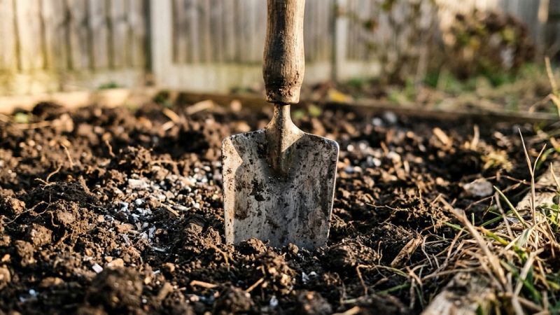
- Have a certified lab test soil from the specific spots children use, play areas, garden beds, the base of the house, as separate samples, not one composite. Compare results to California’s 80 mg/kg, the EPA’s 200 mg/kg, and the 1,000 mg/kg hazardous-waste line. Separate samples are how you find the hot spot the EPA method averaged away.
- Test the parts the cleanup skipped
- The EPA tested only the scraped ash footprint. If you live in the burn zone, test the areas outside it too, the Army Corps did not.
- Test your child’s blood lead
- Ask a pediatrician for a blood-lead test, especially for children under 6. It is the only way to confirm exposure, because lead poisoning often shows no early symptoms.
- Wash hands before eating
- Handwashing before every meal and snack, and after outdoor play, breaks the hand-to-mouth pathway at the point where soil would reach the mouth.
- Remove shoes at the door
- Taking shoes off stops contaminated soil from becoming indoor dust, the primary way outdoor lead moves inside.
- Cover bare soil
- Grass, mulch, or ground cover keeps contaminated soil from turning into airborne dust and blocks direct contact.
- Control indoor dust with HEPA
- Wet-mop hard floors, wipe surfaces with a damp cloth rather than dry dusting, and use a vacuum with a HEPA filter, which captures fine lead-bearing particles that standard vacuums recirculate.
- Garden in raised beds
- If you grow food, use raised beds with clean, tested soil and a barrier at the bottom, and wash all produce thoroughly.
Why This Matters Now
The Eaton Fire is a year in the past. The lead it deposited is not. It sits in Altadena soil today, at levels the EPA calls reassuring on average and Whelton calls unrepresentative in detail.
Both descriptions can be true at once, and that is the point. The median of 31 mg/kg is real. So is the 705 mg/kg lot, the 17 properties over California’s line, and the fact that the testing covered only 1% of homes and only the scraped footprint of each. An average is a summary, not a map. A child is exposed at a place, not at a median.
For the household returning to a burned neighborhood, the safest assumption is the one the source control principle demands: locate the contamination before you trust it is gone. Test the specific soil your family touches, test the areas the cleanup skipped, and cut the hand-to-mouth, tracked-in, and dust pathways in the meantime. The fire’s lead is decades stable and present-day dangerous, and finding it, not averaging it, is what keeps it away from a child.
Sources
- NBC News, Evan Bush, "Los Angeles-area wildfires left lead in soil, but how much and where remains contentious" (May 20, 2026):
- U.S. Environmental Protection Agency (EPA). EPA's Eaton Fire soil sampling confirms federal cleanup protocols effective :
- NBC News. LA fires aftermath: lead and metals contamination in California homes :
- Los Angeles County Department of Public Health, soil testing information:
- U.S. Environmental Protection Agency (EPA), Protect Your Family from Sources of Lead:
- U.S. Centers for Disease Control and Prevention (CDC), Childhood Lead Poisoning Prevention:
Questions people ask
What did the Eaton Fire leave in the soil?
The Eaton Fire destroyed 9,400 homes and structures in the Altadena area in January 2025 and sent smoke containing lead, arsenic, and asbestos into the air, which settled onto surrounding soil, NBC News reported on May 20, 2026. Many Altadena homes predate the phase-out of lead in paint and pipes, so burning them released lead into the plume.
What did the EPA's testing find?
The EPA tested about 100 homes, roughly 1% of the burned zone. The median surface lead concentration was 31 mg/kg, below California's 80 mg/kg and the EPA's 200 mg/kg screening levels. However, 5 lots exceeded federal standards, 17 exceeded California's, and one reached 705 mg/kg.
Why do scientists disagree about the results?
The EPA pooled soil from 30 locations on each property into averaged composite samples. Andrew Whelton, a Purdue University engineering professor, says averaging obscures hot spots, concentrated high-lead patches at specific points. "The results they have are not representative of the Eaton Fire area," he said. The testing also covered only the scraped ash footprint, not the rest of each property.
What is a hot spot, and why does it matter?
A hot spot is a small area with much higher lead than the surrounding soil, often where cleanup crews missed ash. It matters because children do not play evenly across a yard. A composite average that reports "safe" can hide a dangerous patch where a child actually plays.
What are the lead thresholds I should know?
California considers soil lead worthy of concern at 80 mg/kg, and the EPA at 200 mg/kg. Soil at or above 1,000 mg/kg is considered hazardous waste requiring disposal in a special landfill. The one Eaton property that hit 705 mg/kg was an average, so its hottest patches were likely higher.
How does lead in the yard reach my child?
Through three pathways: hand-to-mouth contact after playing in soil, contaminated soil tracked indoors on shoes and pets that becomes house dust, and bare dry soil that turns into airborne dust. Toddlers are highest-risk because of normal hand-to-mouth behavior, and lead is a neurotoxin that harms cognitive and behavioral development.
How should I test my own soil?
Have a certified lab test soil from the specific spots your family uses, play areas, garden beds, near the house, as separate samples rather than one pooled average. Also test areas outside the scraped ash footprint, which the EPA study did not cover. Compare results to the 80, 200, and 1,000 mg/kg thresholds.
What can I do at home to reduce exposure?
Test your soil and your child's blood lead, wash hands before eating, remove shoes at the door, cover bare soil with grass or mulch, wet-mop and use a HEPA vacuum to control dust, and garden in raised beds with clean soil.
Have questions about the environment inside your home?
Air quality, mold, EMF, light and water all shape how a house feels and how the people in it feel. Whatever your concern is, the first step is finding out what is there.
Our certified team of environmental professionals and advocates can help.