


FEMA Paid 29% of Flood Claims to Houses Outside High-Risk Zones
A flood zone answers one question: whether a bank can require coverage. From 2014 to 2024, 29 percent of federal flood claims came from houses on the safe side of that line.
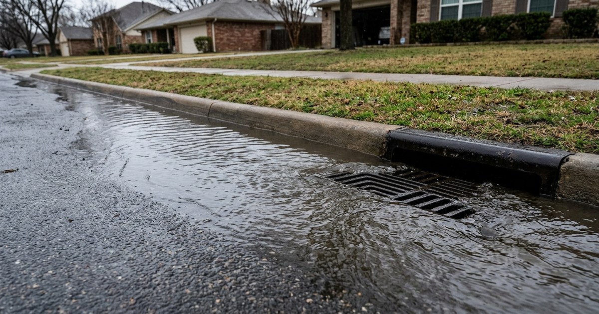
Table of contents
Summary of this article
- Between 2014 and 2024, 29 percent of claims paid by federal flood insurance came from areas outside current high-risk zones.
- A flood zone determines whether a lender can require coverage. It is not a statement that a house stays dry.
- A house inside a Special Flood Hazard Area carries roughly a 1 in 4 chance of flooding during a 30-year mortgage.
- A standard homeowners policy does not pay for flood damage anywhere in the United States. Coverage outside high-risk zones is available and rarely bought.
- A 500-year floodplain means roughly a 0.2 percent chance in any given year, not one flood every 500 years.
- Flood maps model rivers and coastlines. Rain that lands on a street and finds nowhere to go is a separate problem no hazard map covers.
- FEMA has not mapped every address. Where nobody funded the study, a flood check returns empty, which reads like reassurance but is an unanswered question.
- Flood policies carry a waiting period before they take effect, so buying one the week a storm is named is already too late.
A closing packet runs to roughly 40 pages, and one of them says the house sits outside a high-risk flood area. Nobody reads it aloud. It lands like good news.
That page says almost nothing about the house. It answers one question the lender asked: does anyone have to require flood insurance here?
Between 2014 and 2024, 29 percent of claims paid by federal flood insurance came from areas outside current high-risk zones. Nearly a third of the money went to houses a map had already reassured.
Here is what a flood zone actually determines, where the payouts went, and what a homeowner can check that no national map covers.
A flood zone answers a lending question
FEMA letters high-risk areas A or V and calls them Special Flood Hazard Areas. A house inside one carries roughly a 1 in 4 chance of flooding at some point during a 30-year mortgage.
That number is worth sitting with, because most people hear “flood zone” and picture something rare. One in four is not rare.
A drawn line also creates an outside, and outside means only that: not dry, not safe, outside. A house half a block past the boundary gets no mandate, no required premium, and no statement of any kind about water.
Nearly a third of claims came from the safe side
The 29 percent figure is the part that should change how the paperwork reads.
Almost nobody in that group was required to carry a policy. They bought one because an agent pushed, or a storm rattled them once, or the creek two streets over had been running higher each spring. The water arrived and a check followed.
Their neighbors took the same water and received nothing, because a claim requires a policy behind it, and most people outside a mapped zone never buy one.
A standard homeowners policy does not pay for flood damage anywhere in the United States, not for a river over its banks and not for a street that turned into a canal. Coverage outside high-risk zones has always been available and priced on its own terms. The reason few people ask is that a lender who says nothing sounds like a lender saying everything is fine.
A 500-year floodplain is not a flood every 500 years
Land in that band carries roughly a 0.2 percent chance of flooding in any given year. A flood there next spring breaks no rule.
The name does real damage. Five hundred years sounds like a cathedral or a comet, three lifetimes away and someone else’s problem. What it describes is a smaller annual chance than a high-risk zone, accumulating across every year of ownership, with no requirement to insure any of it.
A warning nobody enforces arrives as an all-clear, because the mandate is the part people notice. Tell a buyer the premium is optional and they hear that the risk is optional.
Rain does not check which zone it is in
Flood maps model rivers and coastlines. Rain landing on a street and finding nowhere to go is a different problem entirely. The maps behind those zones depend on federal data, and the climate assessment that feeds them is now run differently.
A culvert packed with leaves. A field upstream that became a parking lot last spring. A storm drain sized decades ago for a smaller subdivision. None of that appears on a hazard map, and each has put water through a back door in a neighborhood a lender called low risk.
Then the scale drops smaller still: which way the ground slopes in a side yard, where a downspout empties, whether a driveway funnels heavy rain at a garage door. Those decide what happens to one specific house, and no federal dataset resolves that finely.
Extending a downspout a few feet does more for a basement than any map revision.
Some addresses were never studied at all
FEMA has not mapped every address in the country. Where nobody funded that work, a flood check returns empty, and empty reads like reassurance on a form when it is actually an unanswered question.
An unmapped house floods as readily as a mapped one. If an address falls in that gap, the route is local: a floodplain administrator at the county or city, an elevation certificate, and a neighbor with a long memory. The water often arrives after the wind has gone: a tropical storm’s flash flooding gets worse inland.
The map changes while you live inside it
A flood zone is a snapshot of one afternoon in a watershed office. Watersheds get restudied, and new construction redraws where water travels.
Pave a field upstream, and rain that used to soak into soil runs downhill fast looking for a low point. Nothing about the house changed. Everything about the water reaching it did.
Houses move into zones and out of them while their owners sleep through both. The map behind the form at closing can easily be older than the kitchen, which makes “we checked, we are outside it” a sentence with a date attached whether or not anyone wrote the date down.
What a homeowner can actually check
Start with a person rather than a portal. Call the county or city floodplain administrator and ask whether an elevation certificate exists for the address. That document does what no national map can, setting the lowest floor against a flood height calculated for that specific spot.
Ask a neighbor who has been on the street twenty years where water goes in a hard rain. People remember the year it came over the curb and what it carried off. No federal file holds that, and it costs a conversation.
Then walk the ground during a downpour. It sounds unscientific and it answers questions no dataset covers, because water finds the low point within seconds and shows exactly where it goes. Photograph what turns up and let the phone keep the date. Two or three storms of that is worth more to a future claim, or to a future buyer asking hard questions, than any printout of a map.
If the decision is to buy coverage, do it on a calm week. A policy does not take effect on the day it is signed, because a waiting period runs first. The afternoon a storm gets a name is already too late.
A line on a map settles the paperwork. Rain decides the basement.
Sources
- FEMA. FloodSmart, What is My Flood Risk (2024)
- FEMA. National Flood Hazard Layer (2026)
Questions people ask
What does a flood zone actually tell you?
Whether a lender can require you to buy flood insurance. FEMA letters high-risk areas A or V and calls them Special Flood Hazard Areas. Falling outside one means no mandate, not that the house stays dry.
How much flood damage happens outside high-risk zones?
Between 2014 and 2024, 29 percent of claims paid by federal flood insurance came from areas outside current high-risk zones. Almost nobody in that group was required to carry a policy.
Does homeowners insurance cover flooding?
No. A standard homeowners policy does not pay for flood damage anywhere in the United States, whether from a river over its banks or a street that turned into a canal.
What is a 500-year floodplain?
Land carrying roughly a 0.2 percent chance of flooding in any given year. It is not a flood every 500 years, and a flood there next spring breaks no rule.
Why does a flood map miss so much?
Flood maps model rivers and coastlines. They do not model a blocked culvert, a field upstream that became a parking lot, or a storm drain sized for a smaller subdivision. Nor do they resolve to which way a side yard slopes.
What if my address is not on a flood map at all?
FEMA has not studied every address in the country. An unmapped house floods as readily as a mapped one. The route there is local: a county or city floodplain administrator, an elevation certificate, and neighbours with long memories.
Can a flood zone change after I buy?
Yes. Watersheds get restudied and new construction changes where water travels. Paving a field upstream sends rain downhill fast that used to soak into soil. Houses move into and out of zones without anything about the house changing.
What can I check myself?
Ask the floodplain administrator whether an elevation certificate exists for the address. Ask a long-term neighbour where water goes in a hard rain. Walk the ground during a downpour and photograph what you find, letting the phone keep the date.
Have questions about the environment inside your home?
Air quality, mold, EMF, light and water all shape how a house feels and how the people in it feel. Whatever your concern is, the first step is finding out what is there.
Our certified team of environmental professionals and advocates can help.